Contact Us
User Web Portal
-
 Français

Can-Net operates a Virtual Reference Station (VRS) network providing high accuracy GNSS correction signals, serving the Agriculture, Geospatial and Construction markets. High accuracy GNSS correction signals allow users to achieve centimeter-level accuracy, which in turn, enables highly precise user applications across many industries. Delivering GNSS data for real-time and post-processed applications, the Can-Net VRS Network gives users exceptional precision, fast initialization and the largest coverage area in Canada.
Network Highlights:
Over 300 Stations across Canada: The Can-Net Virtual Reference Network supports thousands of active users.
Weathering the Storm: VRS solutions have advanced real-time Ionospheric correction modeling to significantly reduce errors at the rover due to atmospheric activity. Can-Net is continually investing in its network infrastructure and system modernization.
Increased reliability: A fully redundant server system. Its detection system can determine if there are any issues with the primary system. In the event of an issue, the system will be switched to the back-up system allowing users to reconnect with no changes to their settings.
Increased stability of both the primary and backup systems. Providing peace of mind for reliable uptime accessibility to high accuracy corrections.


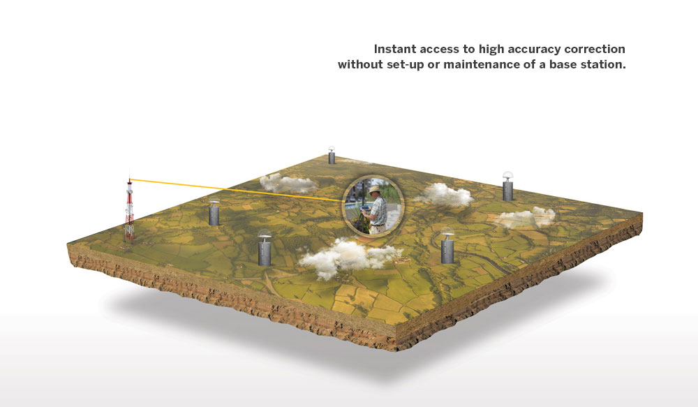
Can-Net VRS Now provides positioning professionals with instant access to Real-Time Kinematic (RTK) and Post-Processing (PP) corrections utilizing a network of permanent (fixed) reference stations. With no base station or setup required, it is cost-effective, efficient and simple to use GPS/GNSS positioning based on a set of reference stations. Simply Connect. Correct. Measure.
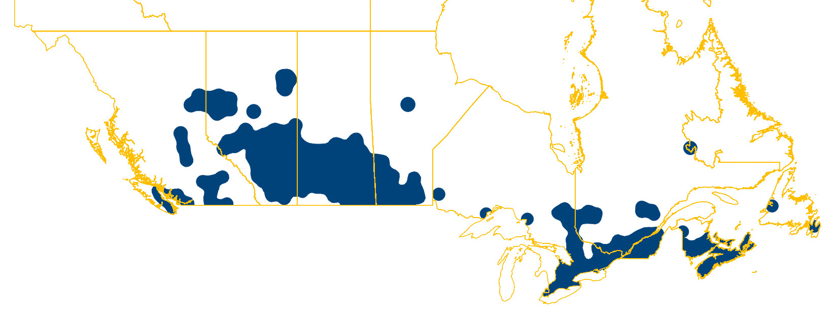 Can-Net Coverage in Canada Today
The Can-Net VRS network footprint spans across Canada, providing instant access to high accuracy positioning anywhere coverage is indicated on the adjacent map.

Can-Net operates a Virtual Reference Station (VRS) network providing high accuracy GNSS correction signals, serving the Agriculture, Geospatial and Construction markets.